
The Official & Authorized Pix4D Training Center in Iraq & Kurdistan
Official Authorized Software License Reseller
Connecting Real-World Field Coordinates to Advanced Geospatial Intelligence
From drone photogrammetry and satellite imagery analysis to earning an internationally recognized Pix4D certification, and collecting centimeter-accurate data with RTK GNSS devices — turning geospatial data from X to Y into full GIS deliverables.
Pix4D
Authorized Pix4D Center
± 0.8 cm
RTK Centimeter Accuracy
QGIS
Open-Source QGIS System
100%
100% Genuine Licenses
Geospatial Data Workflow
1
High-Precision RTK Surveying
Ground Control Points (GCPs) & Surpad
POINT (X,Y,Z)
↓
2
Photogrammetry & Pix4D Processing
Advanced Pix4Dmatic & Pix4Dmapper Engine
CALIBRATE
↓
3
Spatial Analysis & GIS Implementation
QGIS/PostGIS databases, elevation mapping & NDVI
INSIGHTS
TANUPOY NAXSHA
Mapping Data from X to Y
Core Engineering Services
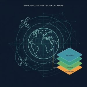
Geographic Information System (GIS) & Remote Sensing Services
High-resolution satellite imagery preparation and analysis for the construction, oil, environmental, and agricultural sectors.

Multispectral Remote Sensing
Analysis of advanced satellite data from Sentinel, Landsat, and PlanetScope. Extraction of NDVI indices, soil mapping, and monitoring of environmental change.
- Extracting vegetation health and crop yield indicators
- Time-series analysis of vegetation and water-surface change
- Mapping urban growth and watershed basins
GIS System Development
Designing multi-user systems for the public and private sectors. Data topology validation and setting up online mapping systems for companies.
- Standard schema and table design
- Pipeline and power utility networks
- Direct integration of field data with servers
3D Terrain Elevation Models (DEM/DTM)
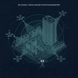
Generating survey-grade Digital Elevation Models (DEM) and Digital Surface Models (DSM), slope determination, and engineering Cut & Fill volume calculations.
- Point filtering to produce clean bare-earth DTM models
- Cut/Fill volume calculations for construction projects
- Generating engineering contour lines for implementation plans
RTK Correction Service for X, Y & Z to the Lowest Margin of Error
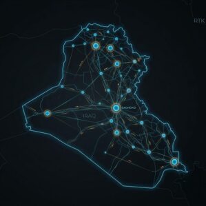
A wide-coverage CORS network delivering real-time positioning correction accurate to near-centimeter level.
- The network covers the entire region
- Real-time correction with minimal latency while working
- Data requires no post- or pre-processing — use it directly in your CAD/GIS software

Compact, Efficient & Fast GPS Device for Data Collection
You don’t need a bulky GPS device to collect field data.
- Smaller and easy to carry
- Efficient in operation
- Start working immediately and connect it to the CORS network

Satellite Imagery Supply
Providing the latest satellite imagery — true color, DEM, and multispectral.
- Fast delivery
- Competitive pricing
Professional Learning & Training
Official Certified Pix4D Center & GIS Training Academy
As the sole official and authorized Pix4D training center in Iraq and the Kurdistan Region, Tanupoy Naxsha trains engineers to a high theoretical and practical standard.
GIS Fundamentals
30 hours

QGIS Fundamentals Course (GIS Essentials)
From beginner to advanced level with QGIS software. Learn coordinate reference systems (CRS), vector and raster data processing, topology error correction, and printing.
- Mastering coordinate systems (WGS84 and UTM zones)
- Buffer, Dissolve, and Intersect tools, plus SQL queries
- Creating professional maps and automating printing with Atlas
View Topics (Full Syllabus)
18 hours of hands-on training
Part 1: Understanding GIS Fundamentals
Understanding the core concepts of geographic information systems, coordinate reference systems (CRS), and spatial data representation methods.
Part 2: Creating and Editing Spatial DataComplete training on digitizing, editing, using snapping, and precisely managing vector and raster data.
Part 3: Creating Professional MapsDesigning attractive, high-quality maps using symbology, labeling, and QGIS’s Print Layout tool.
Part 4: Integrating External DataImporting CAD files, CSV/Excel data tables, georeferencing images, and working with multiple file formats.
Part 5: Performing Spatial AnalysisUsing selection, filtering, geoprocessing tools, data updates, and plugins for advanced tasks.
Official Pix4D Center
Global Photogrammetry Standard
25 hours

Official Pix4Dmapper Training Course
The most recognized and powerful photogrammetry course for drones. Camera setup, placing Ground Control Points (GCPs) in rayCloud, point-cloud cleanup, and standard report generation.
- Drone camera calibration and Bundle Adjustment settings
- Precise GCP marking and orthorectification
- Producing precise Orthomosaic maps for GIS and CAD software
- Generating Contours and DSM
- Precise measurement and Cut & Fill volume calculation
- Issuance of an official international certificate by Pix4D
View Topics (Full Syllabus)
Official International Certificate
Part 1: Photogrammetry Fundamentals & Drone FlightSetting image overlap ratios, calculating GSD, and differentiating between nadir and oblique imagery.
Part 2: Initial Processing & Quality Report AnalysisFinding tie points and camera calibration.
Part 3: Marking Ground Control Points (GCPs) in rayCloudPrecisely marking ground targets within the images, creating check points, and ensuring minimal error.
Part 4: Point-Cloud Classification & 3D Mesh GenerationNoise removal and producing high-quality 3D models.
Part 5: Orthomosaic Map, Elevation Model & Stockpile Volume CalculationExporting GeoTIFF, generating DSM and DTM, and measuring stockpile volumes of soil and aggregate in construction projects.
Next-Gen Photogrammetry & LiDAR
20 hours
Advanced Pix4Dmatic Course
Designed for massive projects and long corridors (over 10,000 images). Combining photogrammetric data with ground LiDAR and generating engineering linework for CAD.
- Fast GPU processing of thousands of large images in a short time
- Camera optimization
- Producing precise data for GIS and CAD software
- DSM and Contour Line data
- 3D data
- Issuance of an official international certificate by Pix4D
View Topics (Full Syllabus)
Next-Generation Photogrammetry
Part 1: Pix4Dmatic Architecture & Big-Data ManagementFast processing of projects with over 10,000 images, using multi-core GPU cards, and managing corridor mapping.
Part 2: Precise MeasurementMeasuring volumes and distances precisely, directly within the software.
Part 3: Producing Data Ready for GIS and CAD
Export all data and use it directly in GIS/CAD software.
Part 4: The Pix4D EcosystemTransfer data directly from Pix4Dcatch to Pix4Dmatic, process it, and upload it to Pix4Dcloud — all without leaving the software.
Official Licensed Pix4D Reseller
Purchase & Supply of Official Pix4D Software Licenses with Engineering Support
We supply genuine, official licenses for Pix4D products, complete with an official company invoice and training for your staff.
For Large Projects & Corridor Mapping
Pix4Dmatic

The advanced, next-generation product for processing over 10,000 images in a single project. Ideal for corridor mapping, power lines, and integrating LiDAR with photogrammetric data.
- 5x faster processing of large datasets using GPU acceleration
- Integration of ground LiDAR data with aerial drone imagery
Genuine license key delivered directly • With official company invoice
The World’s Trusted Photogrammetry Standard
Pix4Dmapper

The world’s most trusted photogrammetry software. Editing rays in 3D space, marking control points, and generating orthophoto maps and dense point clouds.
- Viewing and editing 3D rays in the rayCloud environment
- Detailed quality reports comparing survey control points
- Exporting GeoTIFF files, DSM elevation maps, and LAS point clouds
Special pricing for universities and the private sector • Ongoing technical support
Field Data Precision & Survey Equipment
Real-Time Coordinate Correction During Survey and Fieldwork Using RTK, to the Smallest Margin of Error
In partnership with survey-equipment companies to supply RTK/PPK GNSS receivers with centimeter-level accuracy, ensuring that point coordinates and GIS databases fully match real-world ground locations.
Precise Data Collection with Accurate X, Y & Z Coordinates
Collect data with precise X, Y, and Z coordinates accurate to near-centimeter level, in the shortest possible time, so you can use it directly in your GIS software without any doubt about the accuracy of the data’s location.
RTK Devices That Receive Every Satellite Constellation
Receiving GPS, GLONASS, Galileo, and BeiDou signals across 800+ channels to achieve a fast Fixed RTK solution.
Recording Ground Control Points (GCPs)
Collecting control points to millimeter precision, in a format ready for direct import into Pix4Dmatic and Pix4Dmapper.
Real-Time Coordinate Correction While Working
Correcting the X, Y & Z position of your data live while working, with no need for any post-processing.
Survey Technical Specifications
Official Accuracy of GNSS RTK Devices
FIXED RTK
Horizontal Accuracy
8 mm + 1 ppm
RMS RTK Fix
Vertical Accuracy
15 mm + 1 ppm
RMS RTK Fix
Reception Channels
800+ All-Signal
GPS/GLO/GAL/BDS
Correction Mode
NTRIP & UHF
Internal Transceiver
Streamlined engineering workflow: Data is transferred directly to Pix4D without any datum-shift errors occurring between coordinate systems.
Get in Touch
Consult Tanupoy Naxsha
If you need a genuine Pix4D license, want to enroll in our certified courses, or need advanced GPS survey equipment, our team is ready to help.
Request a Consultation & Get an Official Quote
Please select the service, license, or course you’re interested in below.